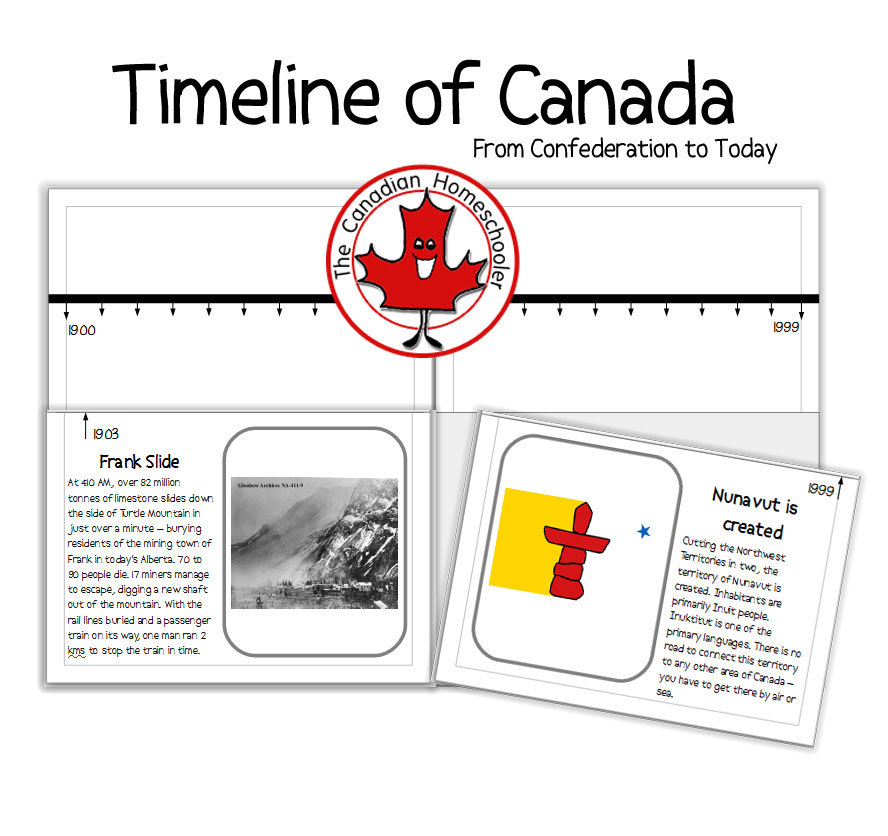
The provinces and territories of Canada have been ever changing since the country first became official in 1867. At first, it was just a few provinces, but over time, has grown to become the 2nd largest country in the world. Between 1867 and today, Canada has divided its land into 13 distinct provinces and territories, with the last one not being defined until 1999!
Here’s a fun way to learn when each province or territory became part of this country.
The Provinces and Territories of Canada Flag Matching Game
Materials Needed
- Large map of Canada (I used the {affiliate link} Unique Media Map of Canada)
- Printed out Provincial flags
- popsicle sticks
- glue
- playdough
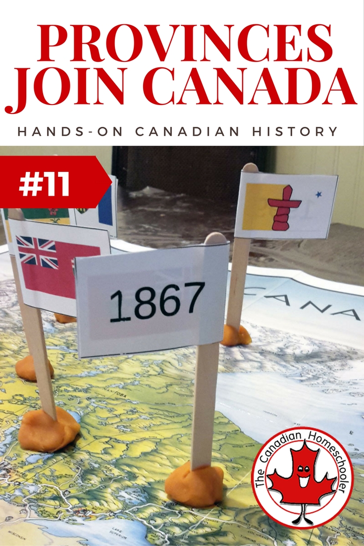
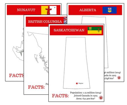
- Print out the flags sheets and cut out each rectangle. Fold them in half around a popsicle stick and glue in place.
- Stick the popsicle flags into small balls of playdough so they can stand up.
- Open up your map of Canada and match the flags to the correct provinces/territories. Stand them in place on top of the location they represent.
- Once that is easy, add a challenge and only look at the dates on the back. See if you can figure out what flags go where only by the date. This is tricky because there are multiple provinces at some points along the way!
Each of the flags has the provincial flag on one side and the date it officially became part of Canada on the back. You can use this game just as a way to match the flag with the province it represents as well as a way to see the year it joined.

Canada's geography is amazing. We have such a variety in the landscape from the east coast to the west coast Read more
Do you want your kids to learn all about Canadian Provinces and Territories? Here we have rounded up some great Read more
If you are studying Canadian history, you might find this timeline a handy addition to your lessons. This part two Read more
If you are studying the geography of Canada, these cards can help your child discover the different provinces & territories Read more

- Homeschool Spelling Essentials: Ways to Make it Engaging (and Canadian!) - October 4, 2024
- 10 Simple Homeschool Organization Tips For Busy Homeschoolers - September 16, 2024
- 5 Ways Homeschoolers Can Enjoy Back to School - September 10, 2024